12 in 12 River Number 12: The Savannah River

SavRiver9

Number 12! Liz and I decided to paddle a section of the Savannah River, about an hour and a half inland from the coast, near Newington. We planned to put in at Poor Robin landing and take out at Blue Springs, winding between Georgia and South Carolina for 6-7 miles. We downloaded a map from USGS and set our sights on a warm December Sunday.

SavRiver17

We wound through cotton country and dirt roads to drop a car and set up our takeout shuttle.  After leaving a car at Blue Springs, we put in at Poor Robin and set off down the river.

OLYMPUS DIGITAL CAMERAFriends who had paddled the Savannah earlier in the season reported alligators that followed them down, but we saw very little wildlife, with the exception of a blue heron and lots of buzzards.  It was a quiet day on the river, with only a few hunters passing us in powerboats.

SavRiver11

We decided to explore one of the cuts which was home to several homegrown houseboats.

SavRiver15

As with many of the Georgia rivers we paddled this year, the Savannah had remnants of docks (and boats) from other times.

SavRiver12

With the sun mostly behind clouds and mist, we stopped for lunch (in South Carolina!).

SavRiver10

Even the dark day was beautiful.

SavRiver18

OLYMPUS DIGITAL CAMERA

And then suddenly, the take-out.

OLYMPUS DIGITAL CAMERA

We did it! Twelve Georgia Rivers in 2012!  A great day, a great experience, and many, many more to come in 2013.

SAvRiver7

Posted in 12 in 12, Georgia Rivers, Savannah | 1 Comment

12 in 12 Rivers 10 and 11: The Oconee and Altamaha

On the morning of the third day of our 4-river trip, mist drifted off of the Ocmulgee onto our sandbar campsite.  (Days one and two were the Ocmulgee and Little Ocmulgee.)

ocmulgee16-2

We headed down the Ocmulgee toward the convergence – where the Oconee would join the Ocmulgee and become the Altamaha.

ocmulgee18-2

OLYMPUS DIGITAL CAMERA

It was only an hour and a half of paddling to the convergence.  We’d had some concerns about rough water, but low water levels meant that the convergence was calm.

ocmulgee20-2

Liz and I peeled off to explore the Oconee.

oconee13-2

The water was so low that we barely cleared the bottom, and paddled sideways to catch water.

oconee5-2

The level of the water was also reflected in the high docks we paddled underneath.

OLYMPUS DIGITAL CAMERA

River 10 – the Oconee!

OLYMPUS DIGITAL CAMERA

We headed back toward the Altamaha, meeting Jim at the convergence.

OLYMPUS DIGITAL CAMERA

We entered the wide Altahama, the last leg of our trip.

ocmulgee19-2

We had four hours of wide water and wildlife.

oconee6-2

altahama1-2

altamaha7-2

Jim’s friend met us at the take out.  The section of the Altamaha we paddled was our eleventh river –  we’re looking forward to exploring more of it on a future trip.

altamaha3-2

altamaha8-2

Posted in 12 in 12, Georgia Rivers | Leave a comment

12 in 12 River 9: The Ocmulgee

On day two of our three-day trip, a friend of Jim’s helped us with a shuttle, and we put in on the Ocmulgee early Saturday morning.

We were treated to miles of winding river, with sandbars that appeared around almost every turn.  Due to the drought and low water level, many of the sandbars had more vegetation on them than Google Earth images had led us to expect.

We saw interesting rock formations along the way:

We were all fascinated by the remnants of docks and tie-ups left from the history of logging in the area.

We did a little research on our return and learned a great deal about the history of the Ocmulgee from the New Georgia Encyclopedia.  We especially loved the link on the timber rafts.

We finally chose a sandbar, and made camp.

After a great dinner, we were treated to a gorgeous sunset:

The Ocmulgee – our ninth river!

Posted in 12 in 12, Georgia History, Georgia Rivers | 1 Comment

12 in 12 River 8: The Little Ocmulgee

With invaluable help from Liz’s friend Jim, we embarked on a three-day trip to paddle four rivers – the Ocmulgee and Little Ocmulgee, the Oconee, and the Altamaha.

We drove up to Lumber City, GA (where we stopped for ice and saw this, er, unique use of display area in the local gro (heady!):

We set up camp at the Little Ocmulgee State Park campground, a perfect spot made all the more, um, magical when spots on either side of us were claimed by a boisterous cub scout troup.

We headed right out onto the lake, which as been created by damming the Little Ocmulgee.

Although signs warned us about alligators, we we saw none.  What we did come across was this (insert your favorite collective noun here – all are used to describe groups of storks:) clatter, filth, muster, phalanx, or swoop of wood storks…

…and lots of lily pads.

The next day, on our paddle on the Ocmulgee, we found the tiny, remaining feed of the little Ocmulgee – our eighth river!

Posted in 12 in 12, Georgia History, Georgia Rivers | 2 Comments

12 in 12 Rivers 6 and 7: Little Ogeechee and Salt Creek

After much schedule madness, Liz and I finally got on the water on Saturday, July 28th.  We were joined by our friends Dan and Gerry.  Gerry guided us to the put in for the Little Ogeechee, then we shuttled cars to the Lott Island public boat ramp on Hunter Air Force Base.  We returned to the put in to load boats from a bridge overpass – treacherous, but we managed it without injury to bodies or boats.

We paddled upriver – against the tide – getting as close as we could to the source of the Little Ogeechee as the falling tide would allow.

We saw no other people on the water, but did see lots of birds, including wood storks, blue heron, egrets, and a tri-color heron. Two alligator sightings gave us a start, but they dipped below the surface and we hurried on by.

We paddled by old rice canals dotted with wild rice. Jim Byous’ essay on the Fortresses of Savannah describes how the rice canals and watery landscape were used against the Union troops:

The typography of Savannah accentuated the fortifications and helped create its own defense. On a peninsula, Savannah was surrounded by marsh mud, water, man-made dikes and rice fields that created a formidable moat for any invader. To slow the Yankees all that was necessary was to open the flood gates and guard the causeways. In a field near Savannah, Iowa infantryman Charlie Albertson wrote upon arriving there, “We had a fine time coming through when not marching too hard… We live on rice and Homony, or rather corn. They raise plenty of rice here. It grows in the water, they have levies and gates to cut off the water and let it on… Some times we march all night. Most through mud and water, sometimes almost knee deep.” Evaluating a potential charge across the mud and water he added, “We have a large force here…. We could easy take Savannah by storm but we would lose a great many men, And I for one do not feel ambicious to charge the large Reb fort in front of our division.”

When we could get no further, we turned around and headed downstream, with the tide.  After we passed the put in, the river widened and sandbars appeared, which presented good opportunities to stop for a stretch and a swim.

Liz and I took a side trip up Salt Creek – our seventh river!

It was a long paddle on a hot day – we were all happy to sit in the shade, hydrate, and eat cold watermelon.

Rivers six and seven – complete!

Posted in 12 in 12, Georgia History, Georgia Rivers | Leave a comment

12 in 12 Paddle number 5: Delegal Creek

I have been boating on most of these local salt water rivers all of my life, but Delegal Creek is one I have seldom been down.   To enter the creek by a power boat, one must know the channel that leads to this creek very well.   You enter this creek through Steamboat Cut from Green Island Sound.  This area becomes very shallow at low tide and has left many a boater stranded on a mud bar waiting until the incoming tide lets him leave again.  The shortest and most direct way to access this creek is from Skidaway Island, a private, exclusive, gated community that was developed on an island that I used to play on as a child.  My father used to take me over to the island by boat to explore the inside and look for deer (this was way before the bridge was built and long before the Landings community was established).   I even had a picnic lunch date on its southern tip before the development and golf course were completed.

Gerry Cowart, a paddle buddy and fellow 12 Georgia rivers in 2012 participant, invited Mary and me to join him to paddle Delegal creek in conjunction with a Skidaway Island Kayak Club outing.  This paddle was scheduled around a VERY high tide, along with a VERY full moon.  It was going to be a high tide of close to 10 feet, well higher than our average of 6-7 feet.

When we arrived at the Marina, the tide was already very high and most of the marsh grass was covered and it wasn’t high tide yet.  This high tide was going to be enhanced even more by the wind that was blowing straight in from the  east and directly downriver.  The incoming current was running so fast that it was making a wake against the concrete pilings!  This marina really has a nice storage system for the resident’s kayaks.  I was so impressed I took several pictures, hoping, in the future, to possibly recreate at my own house.

Gerry had prearranged for a friend and co-worker of his, Emad, to prepare a Lebanese style dinner for us.  It was DELICIOUS, and as we dined we enjoyed a stiff breeze from the ocean.

Pre-kayak dinner

Close to sunset, we all launched from a very cool custom kayak launch.  Launching from this was akin to coming out of a downhill ski racing gate (well, sort of if you have an imagination).  Everyone launched successfully, but those that entered the water prior to others, either had to paddle into the wind to hold position, or park in what little marsh was left.

Once everyone was ready to paddle we paddled with the current and traveled along the back side of Green Island (see previous post # 4).  The marsh was completely covered by the high tide at this point and we were able to paddle over some very shallow areas that we would not have normally been able to paddle over.  We had a new & several fairly new paddlers with us and they all did great.

Paddling was almost effortless, made easy by the wind and incoming tide.  (I wondered what the return trip would be like, paddling against the wind but with the outgoing tide.)

It seems like no sooner than we started, the sun started to drop and left us with a beautiful sunset (as we had hoped)

As the sun dropped into the west, we turned around and began our paddle back to the marina.  We had a few more moments of sunlight before the full moon was to rise.

As we continued our way home, the moon was rising from the east.  It was going to be a GORGEOUS full moon as predicted (however, my pictures did not do it justice).  The wind, coupled with the slight chop made it difficult to get a great picture.  The return trip was a little more difficult, paddling into the wind, but, on the bright side, we burned off the calories we consumed at dinner.   Again, it was a great paddle, with great people.  Who could ask for more????

Five Rivers!

Posted in 12 in 12, Georgia Rivers, Savannah | Tagged , , , , | Leave a comment

12 in 12 Paddle Number 4: Vernon River

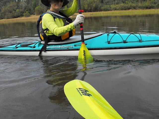
After making a concerted effort to get inland on our first three paddles, Liz and I decided to find some nearby salt water that we hadn’t paddled. We settled on the Vernon River, which rises south of Hunter Army Airfield and flows 12.5 miles through Chatham County to the sea. Liz and I were joined on this paddle by Dan, and the three of us launched from Skidaway Narrows (Butterbean Beach) under bright sun and on an outgoing tide.

Our destination was Green Island, a small island tucked in behind little Wassaw. The island is now privately owned, but Liz had visited the island often as a child, exploring the island on day visits and overnight camping trips with her family.

Skidaway Narrows to Green Island

Although the Vernon was our main paddling destination, we put in on Skidaway River, then crossed Moon River and through a Burnside Island canal to the Burnside River. (A little shortcut in deference to the various cranky body parts on that day’s trip.)

Burnside Island Canal

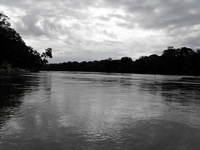
Once the Burnside river met the Vernon, it was big water all the way. We had the wind against us, but the out-going tide made it easier going.

Vernon River at Burnside River

After a little over six miles and two hours, we reached Green lsland.

Green Island

Liz’s good planning put us there at low tide so that we could enjoy a meal and a slack tide rest.

Green Island at low tide

Green Island is a great example of a maritime forest. These island forests advance and retreat as coastlines are reshaped by tides and storms. Often found in maritime forests are Live Oaks (Quercus virginiana), Southern Pine (Pinus sp.), Southern Magnolia (Magnolia grandifolia), Cabbage Palm (Sabal palmetto), Resurrection Fern (Polypodium polypodioidies), and Saw Palmetto (Serenoa repens).

Maritime Forest

In deference to the private ownership of the island, we did not explore the interior, but saw plenty of evidence of the robust population of wild pigs. Liz’s stories of an old fort on the island made us want to learn more.

All we knew about the fortifications on Green Island was that they were a Civil War construction. After a good deal of (online) digging, we found this reference to the fort in the excellent essay “The Fortresses of Savannah” by Jim Byous:

Morale ran high in the first months of the war. Stationed on Green Island, seventeen year-old private Joseph C. Thompson wrote his sister, “If they try us I think they will be barking up the wrong tree for I do not believe there is one man in the Guards who would not die before surrender.”

Despite young Thompson’s determination, the outlying fortifications were easy pickings for the Union forces, and by 1862 they were abandoned. Again, from Byous:

On Sunday February 9, 1862 General Lee sent orders to Colonel Edward C. Anderson, commander of the coastal defenses, saying, “dismantle the Batteries on St. Simons and Jekyll Island, as it is intended to abandon the outside line of defense and fall back upon the interior forts.” By the end of March the guns of Skidaway, Green Island and Wassaw were moved to the interior forts, Thunderbolt and Beaulieu.

Once the tide had turned, we headed back toward Skidaway. Just as we reached Burnside Island, we were greeted by a large pod of dolphin – at least 5 adults and 4 juveniles.

Dolphins

Dolphin

Johnny Mercer‘s childhood home – Vernon View –  was on Burnside Island. and in his honor a part of Skidaway river was renamed Moon River. We crossed both on our way back.

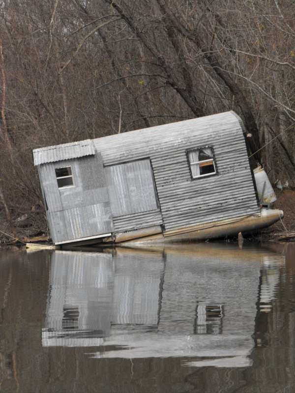
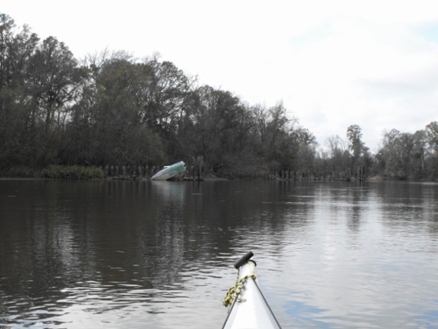
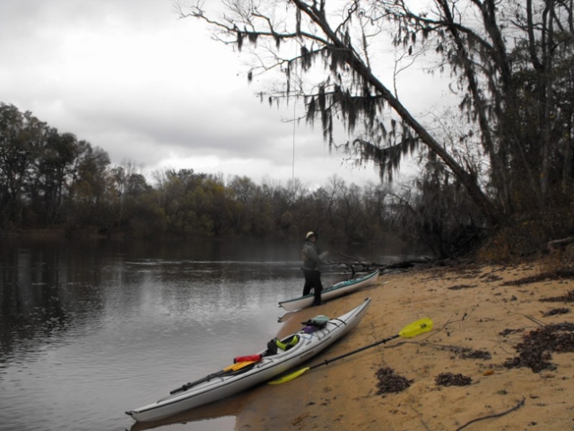
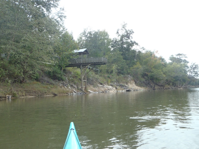
We decided to stop at Pigeon Island to stretch and check out the eagle nest.

Eagle Nest Pigeon Island

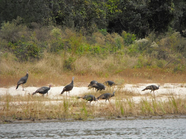
We also saw large prints in the sand that we guess were made by a great blue heron. Although we didn’t see the heron, through the day we saw wood ducks, a mallard, pelicans, cormorants, and a cheeky little guy we’re still trying to identify.

heron prints

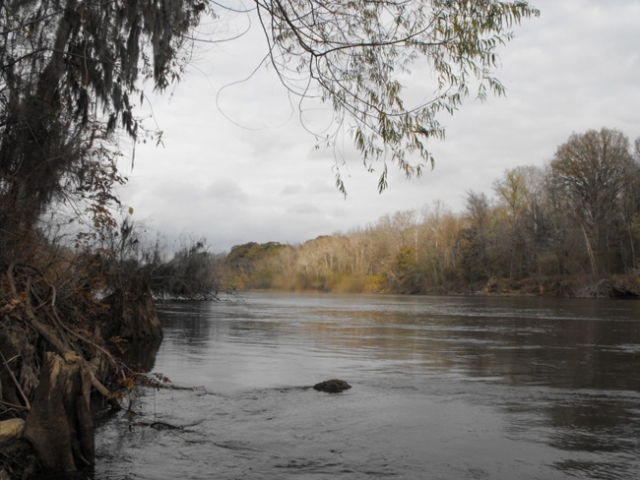
Pigeon Island looks out on the Skidaway Narrows, historically a strategic point in guarding Savannah. In colonial times, the island (also known as Redoubt Island) was used by Capt. Noble Jones and his Northern Company of Marines to patrol the Narrows for Spanish privateers approaching from Florida. Known today as the Atlantic Intracoastal Waterway, the Inland Passage was a critical route to protect colonials from enemy advancement into early settlements. General Oglethorpe authorized construction of a watch house on Pigeon Island in 1740 to warn troops stationed at Jones’ Wormsloe Plantation of approaching invaders. Wormsloe was officially deeded to Jones by a King’s Grant dated 1756, although he had occupied the land since 1736. Pigeon Island was gifted to Jones in 1761 but later passed out of the Jones Family. The island has seen several owners over the years, held at times by individuals, a local family, and private interests seeking to develop the land for home sites. Today, Pigeon Island is once again part of Wormsloe Plantation, which is now a Georgia State Park. The 1997 purchase was part of Gov. Zell Miller’s Rivercare 2000 project benefiting riverfront land facilitating wildlife-management areas, parks, natural and historic landmarks, and greenways.

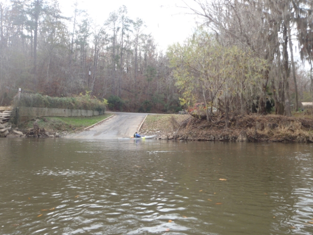
From Pigeon Island it was a short hop back to our put in, and our fourth paddle was complete. We had traveled a little over 12 miles on gorgeous Georgia Rivers.
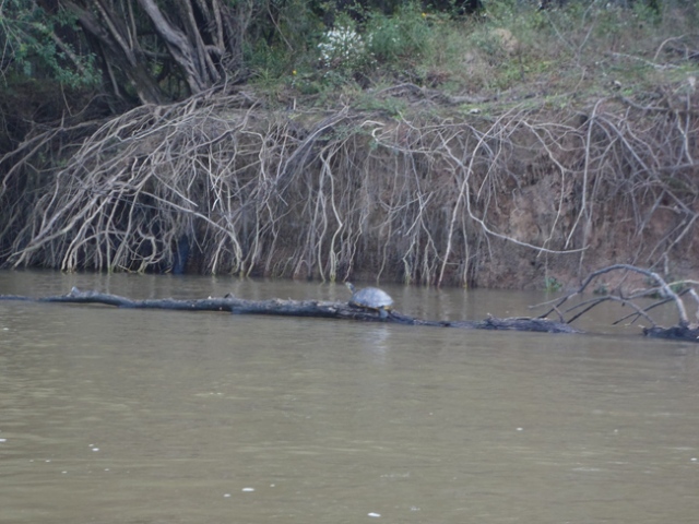
FOUR!

Posted in 12 in 12, Georgia History, Georgia Rivers, Savannah | 3 Comments

12 in 12 Paddle Number 3: Cathead Creek

Cathead Creek is a tributary of the mighty Altamaha River. It drains part of Buffalo Swamp, a tidal forest containing bald cypress, sweet black gum, and water tupelo.  The put-in is on Cox Road off of Hwy 251, where Liz and I met Gerry, Phil and Jay on a sunny and windy Saturday morning for the paddle to Darien.

We had the outgoing tide as we launched into Cathead Creek, which lead us through an undeveloped section of Mclntosh County.

The area was a center of rice production for more than 100 years. Rice canals are still visible and in some cases still navigable – we took a side trip down one of them.

Spring was in evidence everywhere, with cascading Cherokee Rose (Rosa laevigata, the state flower of Georgia, despite being non-native) peeking out from newly-leafed out trees.

Gerry saw a bald eagle, and then about 30 minutes later, sharp-eyed Liz spotted the nest. We got close enough to see movement inside and hear the calls of hungry fledglings.

There were no places to stop along the way until we found a small campsite near the I-95 crossing. After several hours of paddling against the wind, it was a welcome respite.

Liz gave us a brief history of Darien’s boom and bust cycles. Established in 1735 as a military outpost to protect Savannah, Darien was settled by a group of Highland Scots under the order of General Oglethorpe.

From the early 1800’s through the early 1900’s Darien was a center of commercial strength, handling exports (and banking) for cotton, sugar cane,  and rice. South Georgia was heavily forested and at one point Darien was the leading center of timber exportation on the South Atlantic Coast. (The results of this over-cutting led to the practical extinction of the longleaf pine, the story of which is part of Janisse Ray’s wonderful book Ecology of a Cracker Childhood.)

Darien’s economy remains tied to the water; it was a center for oyster cultivation and continues to supply restaurants across the southeast with Wild Georgia Shrimp. As we paddled into Darien, the first thing we saw was shrimp boat rigging.

After ten miles of windy water, we were glad to see our destination.  Paddle number three!

Posted in 12 in 12, Georgia History, Georgia Rivers | Tagged , , , , , , | 5 Comments

12 in 12 Paddle Number Two: Canoochee River

Liz and I were inspired to take this trip by (and with) Georgia river fan Gerry Cowart. Most in Savannah are familiar with the Ogeechee, but how many know it’s cousin, the Canoochee? We were off to find out.

Pre-dawn start Canoochee 12 in 12

The Canoochee River is formed by the merging of Canoochee Creek and Taylor’s Creek near Swainsboro, Ga in Emanuel County. It flows some 85 miles until it meets the Ogeechee River just north of I-95.  The merged rivers continue east to the Atlantic as the Ogeechee. We launched from King’s Ferry (just off Hwy 17)  at the break of dawn on Saturday, Feb 4.  We got an early start in order to take advantage of the incoming tide for our upriver trip, planning to use the outgoing tide on our way home.

Canochee 12 in 12
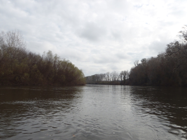
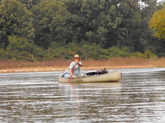
We launched onto the Ogeechee and paddled under Hwy 17 and the thunderous I-95. In about a mile, we came to where Canoochee empties into the Ogeechee. We headed north and soon entered the Fort Stewart Military Reservation, which the river divides.

Canoochee3

Liz and I were quickly distracted by the old rice canals and huge grasses beginning to catch the peekaboo morning sun.  The grasses (Zizaniopsis miliacea, Giant Cutgrass or Southern Wild Rice, a dominant grass in the freshwater tidal area) are over 6 feet tall, and line much of the banks.  Gerry wisely advised us to take advantage of the incoming tide and get as much upstream distance as possible – then dawdle/explore on the way back.

Canochee4

Gerry saw a buck swim across the river (mostly tail and antlers visible). We saw kingfishers, osprey, buzzards, a heron, and some wood ducks.  We took advantage of a creek cut-through to get up close and personal with the river banks.  A smell like wet grass and growing things hung in the air – it turned out to be the bank mud, which had a lighter, brighter smell than the pluff mud we paddle by so often on the coast.

Canoochee Creek

We saw sycamore, cypress, river birch, maple, gum, and plenty of Ogeechee-Lime (Nyssa ogeche). As we got further upriver, the water became less tea-colored and clearer, and we saw more stands of pine and palms.

Pine and Palm Canoochee 6

We stopped at a couple of different landings where the signs had been helpfully ventilated.

Landings Canoochee

lunch on the canoochee

Tea on the Canoochee

The main archeological evidence of human occupation along the Canoochee prior to the 1700’s is an important prehistoric Native American site known as the Lewis Mound.  Pottery from the site just east of Fort Stewart – believed to be a burial ground – dates as early as 2200-1700 BC, with extended settlement  from 1000 to 1500 AD.

Canoochee 1740When General Oglethorpe established the city of Savannah in 1733, part of its function was to act as a buffer between the rich Carolinas to the north and the Spanish to the south.  He established Fort Argyle on the West bank of the Ogeechee near the Canoochee.  The fort was abandoned and resurrected several times until 1767 when it was abandoned for the last time.

In modern times, the river became highly polluted due to runoff from the Claxton Poultry plant. In 2001 three sisters from Claxton – Linda Smith, Claudelle Smith Moinar and Sylvia Smith Reynolds – had had enough of the toxic green swamp that the river they grew up on had become. The sisters successfully sued the Claxton Poultry plant under the Clean Water Act, part of the settlement dictating that the company set aside money to establish a riverkeeper organization. Around this same time, four men from Louisville, GA (nicknamed the “sludge brothers”) started fighting to keep the Ogeechee River free of waste that was contaminating ground water. Their organization became known as the Friends of the Ogeechee River.  The two organizations merged in 2005 to form the Ogeechee Riverkeeper Organization.

Although the pollution is gone and the wildlife plentiful, there is a great deal of evidence of current human occupation. We picked up lots of trash, Gerry filling his entire day hatch with what we charitably called jetsam. (Look it up. We did.)

Canoochee trash

We paddled back on an outgoing tide, but the wind had picked up enough to make it hard work. We stopped to document a few more unknown plants, which were again kindly identified by John Crawford of UGA.

This bamboo-like plant is Arundinaria gigantea which John calls “‘switch cane’, a name well deserved from my coastal Georgia childhood.” It is sometimes called ‘giant cane’ or ‘wild cane.’

Canoochee cane

We kept seeing a bright green hanging plant that was not Spanish moss. John identified it for us as a hanging lichen in the Genus Usnea, called ‘Old Man’s Beard’.

Canoochee beard

We spent 7 hours on the river, covering 14-15 miles of Georgia river.

Canoochee two

Mary and Liz

Posted in 12 in 12, Georgia History, Georgia Rivers | Tagged , , , , , , | 4 Comments

12 in 12 Paddle Number One: Ebenezer Creek

Sunday, January 22nd, 2012

Liz and I were joined on this adventure by Dan, Gerry, and Jay.  We had planned to put in at Long Bridge landing and shuttle to a take-out where the creek feeds into the Savannah River. Gerry was first at the put in, he let us all know that Ebenezer was too low to paddle at that point. The level of the creek varies according to drought conditions (which are severe at this time).  High water periodically flows into the creek from the Savannah River if upriver dams have opened to release water.  Periods of rain will cause the creek level to rise accordingly.

Ebenezer put in

We readjusted and met up at the Ebenezer boat landing on the Savannah River.  The day had been forecast to warm to 70 degrees after morning fog and drizzle, but the temp hovered in the mid-50’s with a strong enough breeze toencourage us to wear all the layers we had.

We paddled upriver (with the tide) into grey, mysterious, and otherworldly surroundings. The river is a habitat for cypress trees (Taxodium distichum), as well as large stands of water tupelo (Nyssa aquatica). Partly due to this rare natural environment, Ebenezer is one of only 4 waterways designated as a Georgia scenic river and is a National Natural Landmark.

The cypress turn the water to a deep tea brown (also known as blackwater). With the historically low water levels, giant cypress “knees” were visible all along the creek.

Ebenezer

We saw beaver sign and pileated woodpecker sign (below).

Ebenezer paddle

We paddled up into a side creek, encountering a thick mat of a floating aquatic plant which we later learned (courtesy John Crawford of UGA) was mosquito fern (Azolla caroliniana). It is sometimes called ‘water velvet’, and it was certainly like paddling over a soft, floating blanket.

Ebenezer 12 in 12

The area was home to the Creek Indians before the German Salzburgers developed their first settlement in 1733, seeking freedom to live according to their religious beliefs. After several years of disease and struggle, the Salzburgers moved down creek to establish New Ebenezer on higher ground at the Savannah River confluence.

The new community prospered until the Revolutionary war, when it was mostly destroyed.  The only building left standing was their church, which is now noted as being the oldest public building still standing in the state of Georgia.  This area  is now a historical landmark and open for visitation.

A hundred years later, the creek was the site of a tragic civil war incident when freed slaves seeking protection followed the army of Union General Jefferson C. Davis to the creek. When the Confederate cavalry closed in on the opposite bank, panic set in and hundreds (or possibly thousands) of the freed slaves became trapped between the opposing armies and perished. Now all that is visible from the civil war history are railroad pilings that still stand in the swamp.

Ebenezer

We stopped at a public boat ramp for lunch and to admire Liz’s singular parking ability (top).

Ebenezer

We went through several stands of swamp tupelo, which Gerry helped us identify by the twisted trunk.

Ebenezer

The palette of grey and brown was broken up by brilliant pink, identified for us by Steve Braden of Savannah Canoe and Kayak as red maple, Acer rubrum.

red maple, Acer rubrum

We estimated that we paddled 8-10 miles in our up and back trip. The section of the river from Long Bridge Landing (Long Bridge Road off of Hwy 275) to the Savannah River is just a little over 10 miles. There is parking available for a nominal fee ($10.00 at present) at the Ebenezer Boat Landing at the Savannah River. You will have to arrange for your own shuttle if you plan on a one-way trip. If the water level is too low to put in from this launch site, there are 2 other sites available to launch from off of Wylly Road and Highbluff Road.

landing

A tip of the hat to A Canoeing and Kayaking Guide to Georgia, a great resource for Georgia paddlers that provided us with ramp locations, history, and other background information for our trip. See you next time!

Mary and Liz

Posted in 12 in 12, Georgia History, Georgia Rivers | Tagged , , , , , , , | 3 Comments